FSTechnology participates in the ESRI Italy 2022 Conference
Virtual Works Management and SUIT, the two FS Group projects presented at the Conference

The Esri Italia 2022 conference, which was held from May 10th to 13th with a renewed format, at the Ambra Jovinelli theatre in Rome and broadcast in live streaming, has just ended.
The digital transformation driving the PNRR [National Recovery and Resilience Plan]: the key role of companies
This was the central theme of the Conference. In particular, the PNRR, ecological transition and the important role of businesses was discussed on the opening day, the 10th of May.
Esri Italia wanted to dedicate its annual Conference to the theme of ecological transition because knowledge of the territory and, more generally, the Science of Where, are decisive factors to ensure sustainable changes.
On this occasion, some projects conducted by FSTech, in collaboration with Italferr, in the field of:
- Virtual Works Management
- GIS as a communication tool
BIM and GIS integration in virtual works management
The work carried out within the project "Virtual Works Management" is in continuity with the BIM GIS integration project, which began in 2017. It demonstrates the advantages of the integration between the two platforms in the activity of the railway infrastructure works management, advantages already widely demonstrated in the design of the works themselves.
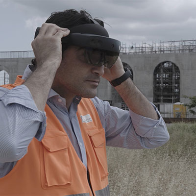
Conducting surveys with drones (point clouds and orthophotography), has allowed us to experiment with remote work monitoring through the most advanced technologies available at the moment. The integration of BIM and GIS data in the cloud through the GeoBIM tool and the development of automatic procedures, allows us to monitor work progress and its quality also thanks to the use of virtual or augmented reality. In the field of sustainability, artificial intelligence is used to evaluate the impact of the construction site on the surrounding environment also thanks to advanced dashboards.
GIS as a communication tool: the SUIT (Land Engineering Single Info Point)
The identification of the final destination sites of the lands and rocks produced during construction distributed throughout the territory, to date is carried out by Italferr, through the implementation of the RFI Civil Works Design Manual which provides, in order to guarantee all the principles of transparency and legality, the official involvement of public bodies, local administrations and bodies experts in the field of land and rock excavation (TRS). In order to respond to the need to pool all the sites identified during the railway design on a geographical basis, FSTechnolgy has proposed the implementation of SUIT, as a GIS Web portal where it will be possible to consult a constantly updated archive of all the possible delivery solutions to which the TRS can be used.
Being able to share the identified sites and the information related to them with the different players involved on a cartographic basis will allow the data to be always updated with the contribution of all and to solve any critical issues that may occur during work due to the lack of availability of the sites previously identified in the design phase by immediately identifying alternative solutions to the grant, already shared with the various Bodies and with the territory, without compromising due work progress.